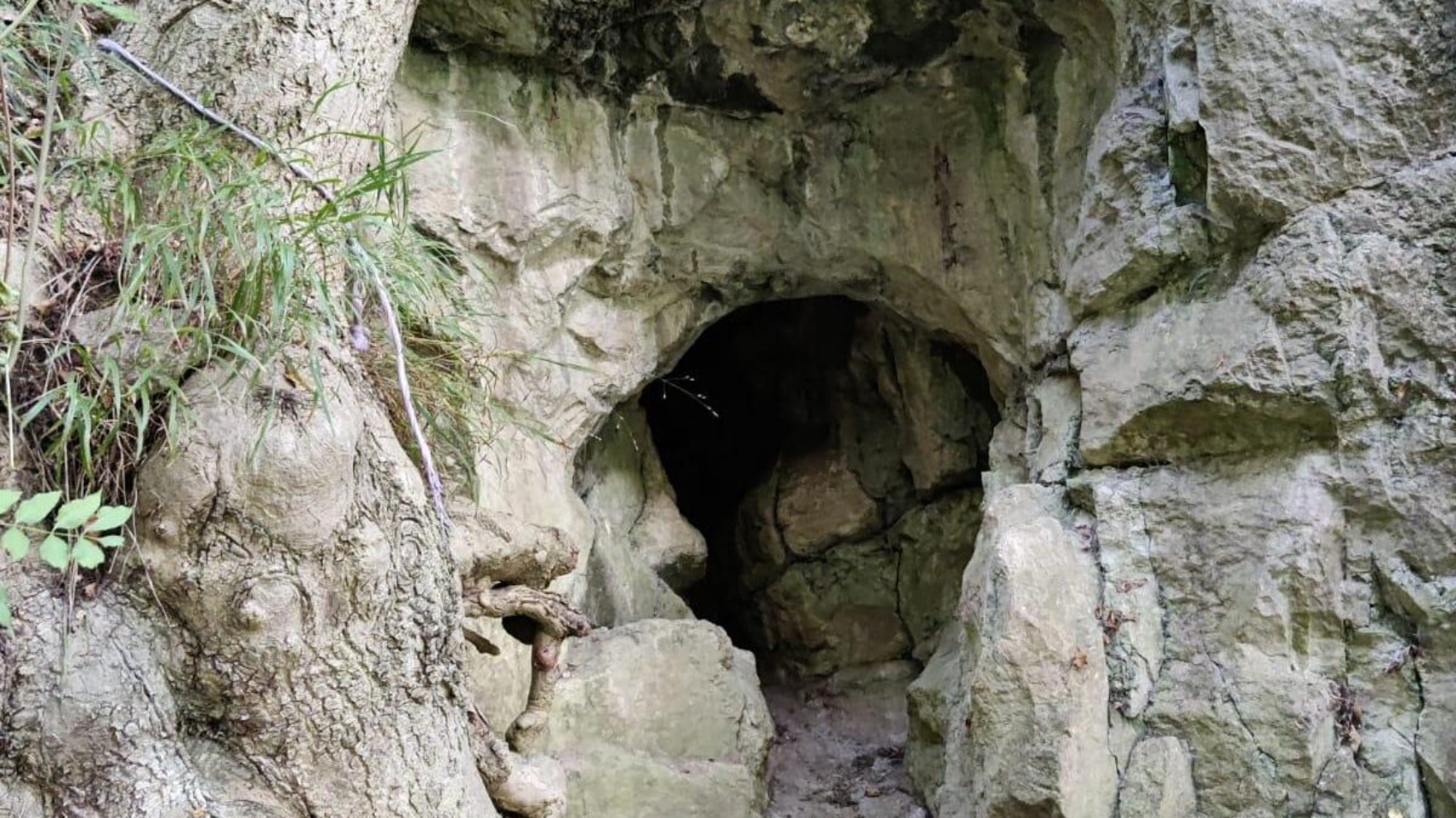
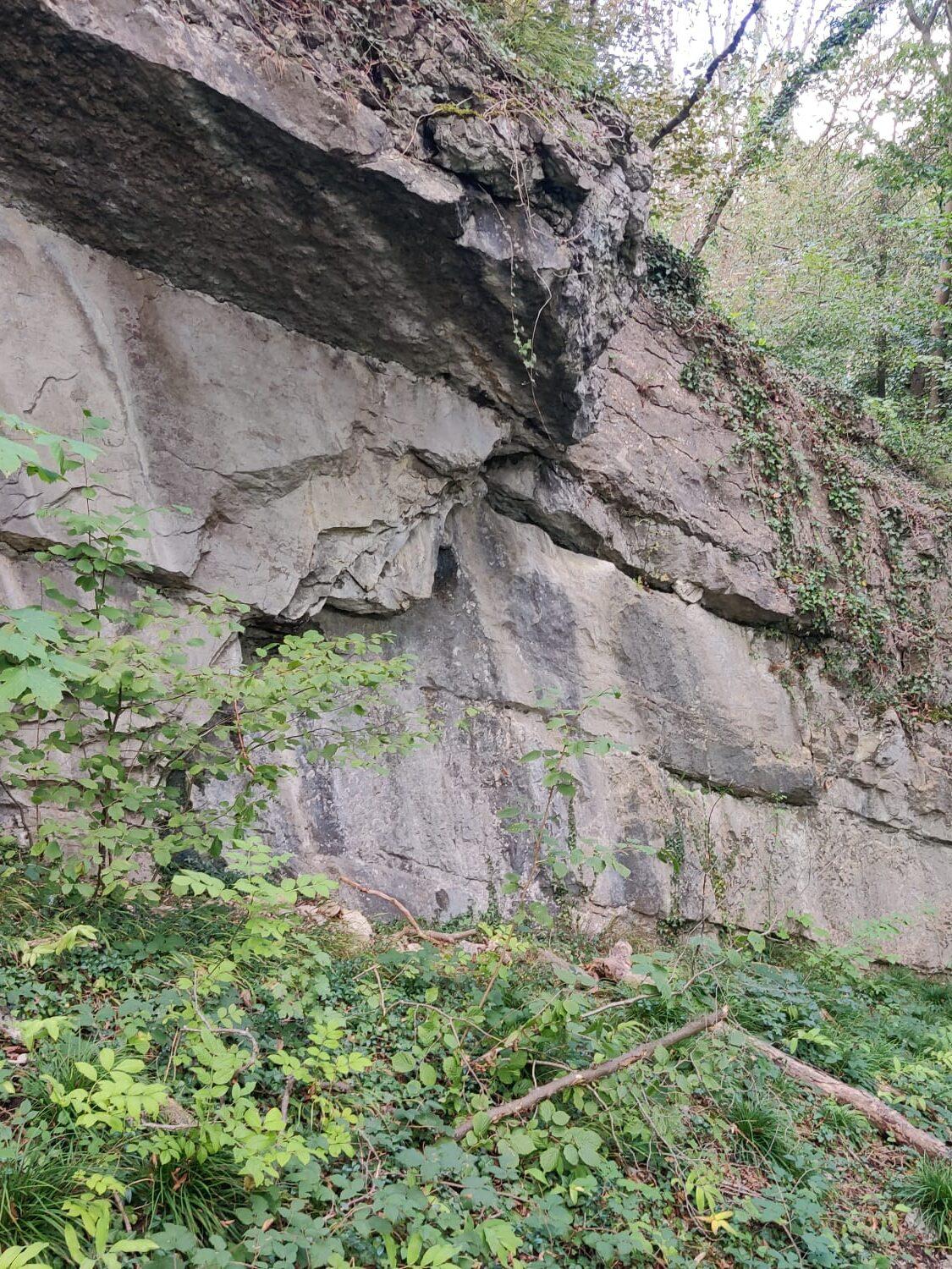
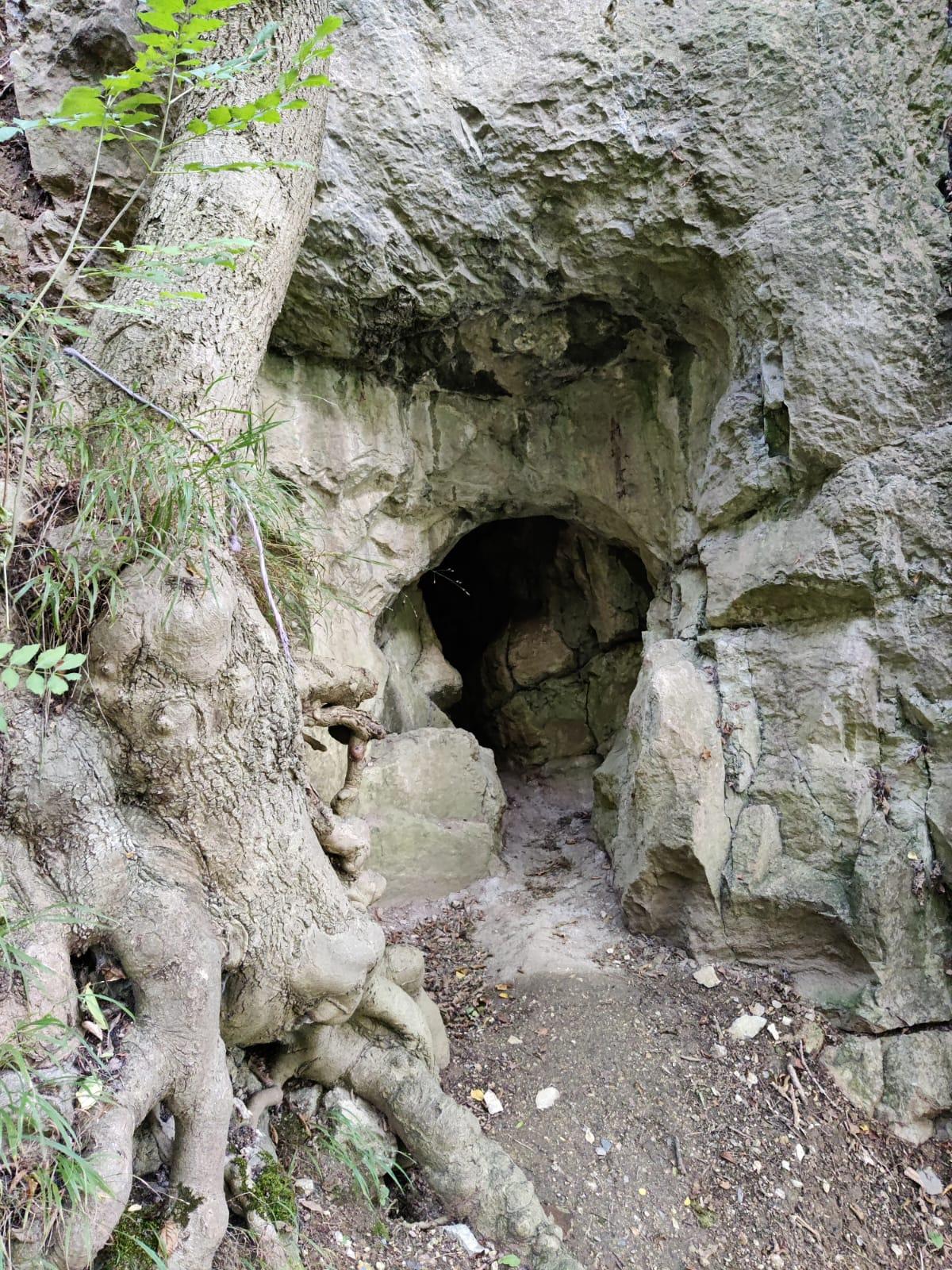
A set of boulders located on a steep incline around a small cave close to the river.
Details
| Attention | Around the cave, climbing is allowed, but don’t use magnesia since the area is protected by “Nature 2000”. |
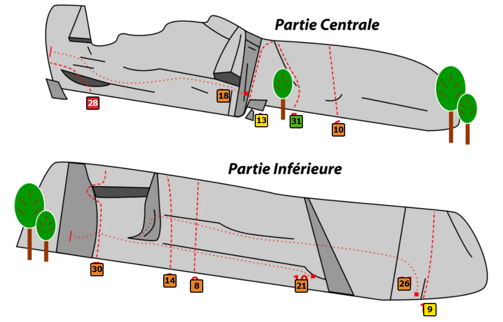
| Level | ~30 routes between FR 3 and 7a (peak at 6A). |
| Access | Approximately 5-minute walk alongside the river to reach the routes. |
| Area | The routes are in the forest, allowing clear light to come through. The routes are on a steep incline and slightly overgrown on the top. |
| Coordinates | 50.603441,5.897549 |
| Navigation | google.com/maps |
| Visit | Due to the steep incline near the routes, we considered it too dangerous to boulder there. |
If you see this after your page is loaded completely, leafletJS files are missing.
Parking
The parking is located at 50.603893,5.893485 (google.com/maps).
Park the car alongside the long fence to not block any roads or fences.
Approach
The routes are approximately 5 minutes of walking from the parking.
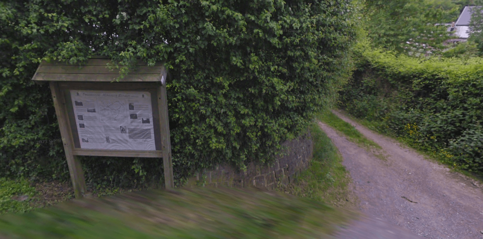
Walk further along the street, you will see a red fire hydrant and a map sign. Take the road in between them.
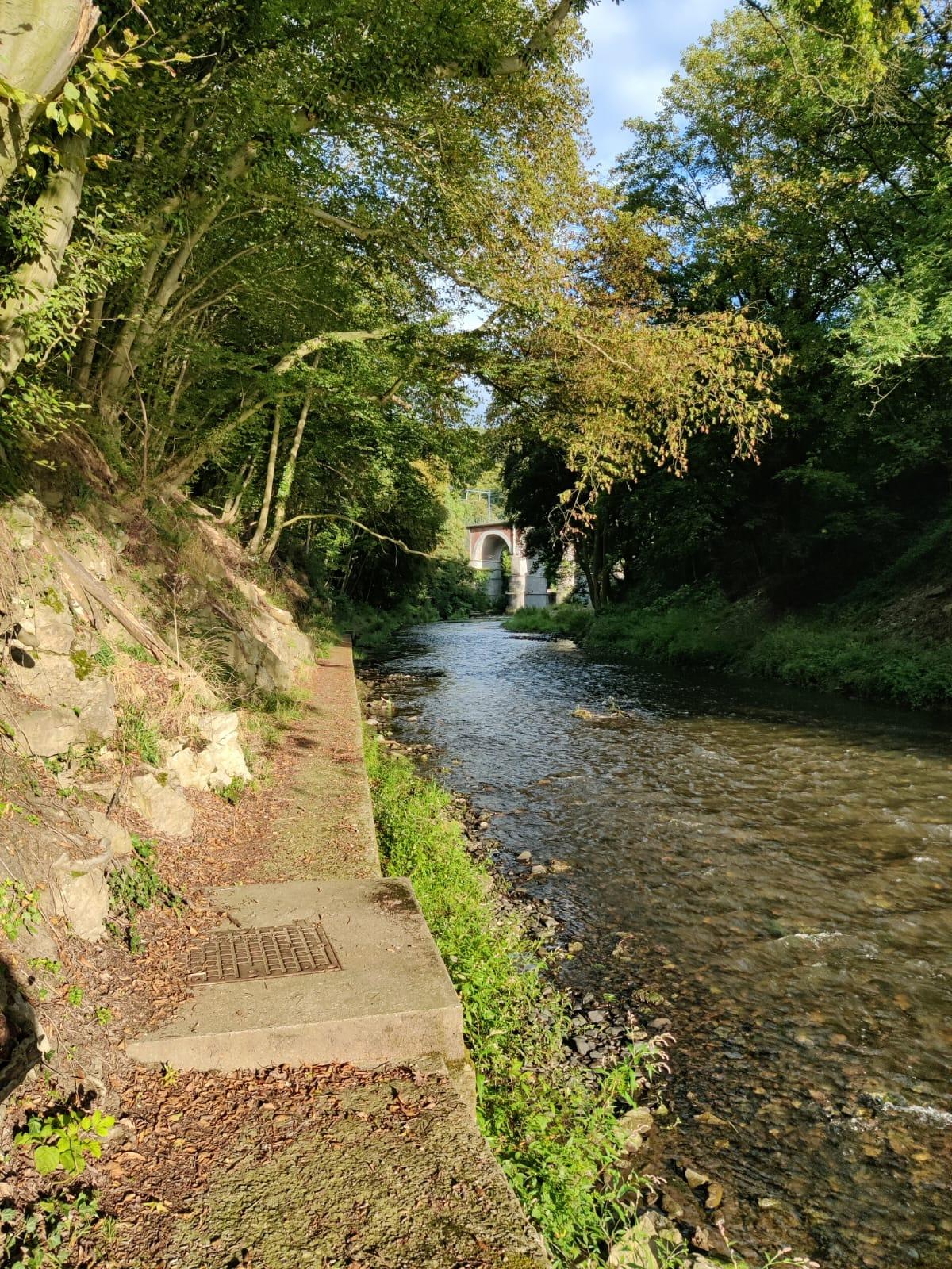
The road will lead you to the river with some concrete stairs and a metal fence. Go around it and follow the path alongside the river towards the bridge.
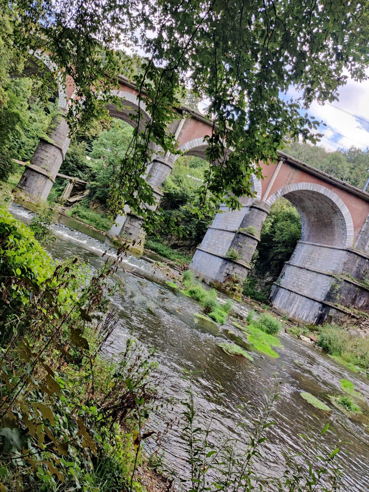
When the river starts curving towards the bridge, have a look to your left. If you go up the hill, you will find the start of the routes. The routes are characterized by some big overhanging rock formations. Following the rock formations further up the hill, you will find the entrance to a small cave.
Boulders
The routes are documented on thecrag.com, backed by a visual representation of the rock formation.